It is quite a way to Xaghra by road but this 20 minute walk will take you there over footpaths and quiet roads. It does involve an over all climb of about 100m and needs some careful route finding at one place.
Maps and GPS datums
See this other Gozo walk for a brief discussion of Gozo maps and GPS datums
Route
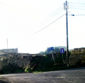
Take the Marsalforn road out of Victoria the just at the northern edge of town turn right. Pass some benches overlooking a small vineyard. Take the left turn marked with the “No through road” sign. The road right, that you are not taking, is signed for Harbour and Sports Centre.
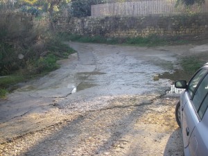
Follow this “No through road” over a slight rise, then down to a ford. Well, it’s a ford in wet weather!
Don’t be tempted down the driveway, left, just after the “No through road” sign. The ford is the headwaters of Wied Marsalforn, which is the river that ends on Marsalforn seafront. After the ford take the left branch of the “Y” and start to rise.
You may meet the Ford Troll. He popped out and asked us if we were going to Xaghra. When we replied that we were he asked if we knew the way. Anxious to avoid a lengthy description of the route we assured him we would manage. Undeterred he offered “I will show you the way”.
“Thanks” we responded with carefully measured enthusiasm.
“It’s up there” was the thankfully brief advice.
The white concrete surfaced road climbs steeply up the side of Ghajn Sellum, with good views of Victoria back over your left shoulder. The surface gets steadily worse, and eventually becomes a sort of concrete crazy paving and then stops altogether.
This next bit is tricky and worth getting right. Where the surface finally fades out you are faced in front with a break in the dry stone wall and it looks tempting to go though it. This is not the way. You must turn left.
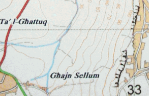
This left turn is the one shown on the maplet just under the ‘um’ of Sellum.
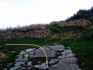
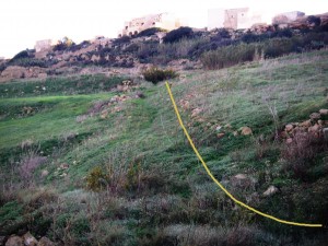
The path drops away slightly. After about 50 – 70m the path opens out into a grassy field and there is no clear way to follow. Look uphill, right, for an old, little used, and somewhat overgrown footpath – a real foot path: not a track. It was blocked when we were there by a large bush with yellow flowers, like gorse but not prickly. Of course the bush may not look the same when you walk the route… Skirt around the bush.
Illustration 3: Turn right, uphill after about 50 – 70 m
Once you find this path it is plain sailing, but still a steep climb, up to Xaghra. The path remains a foot path but gets steadily more worn and used as you approach the village. Indeed parts of it are concrete surfaced in the last 100m or so. I guess it is more used from that direction for short out-and-back strolls. There are great views to left all the from Victoria to Marsalforn.Xaghra has several parts and you will soon enter the western offshoot, Is-Srug.
